Bramall Hall

25th February 2022

Hall road, Bramall, Stockport, SK7 3NX

Today I went to Bramall Hall. I initially thought it would be a quick and easy location to access because I’m not too far from Stockport. However, while the journey wasn’t horrendous, the transport links weren’t great. I caught the 192 bus to Stockport, and then the 379 to Bramall. There are three buses you can get from Stockport, but all of them only run once an hour so I had to wait a while for the first one to arrive. The good thing was I didn’t have to pay any extra for travel, because many Stockport buses are run by Stagecoach, so I just used my weekly bus pass.

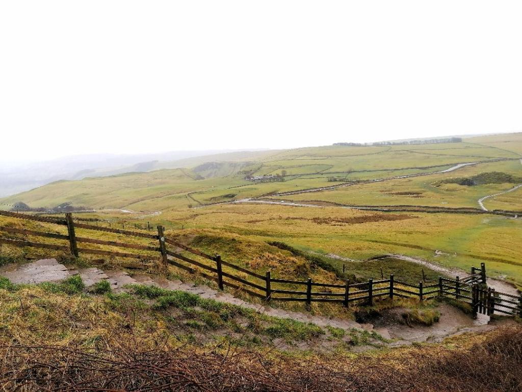
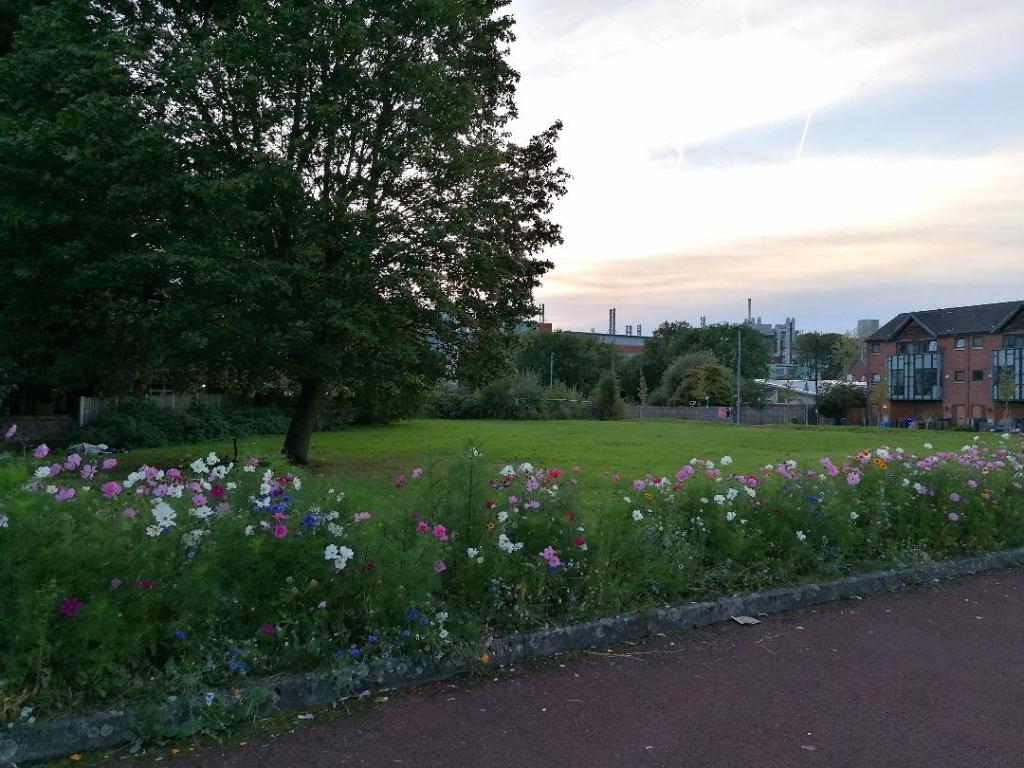
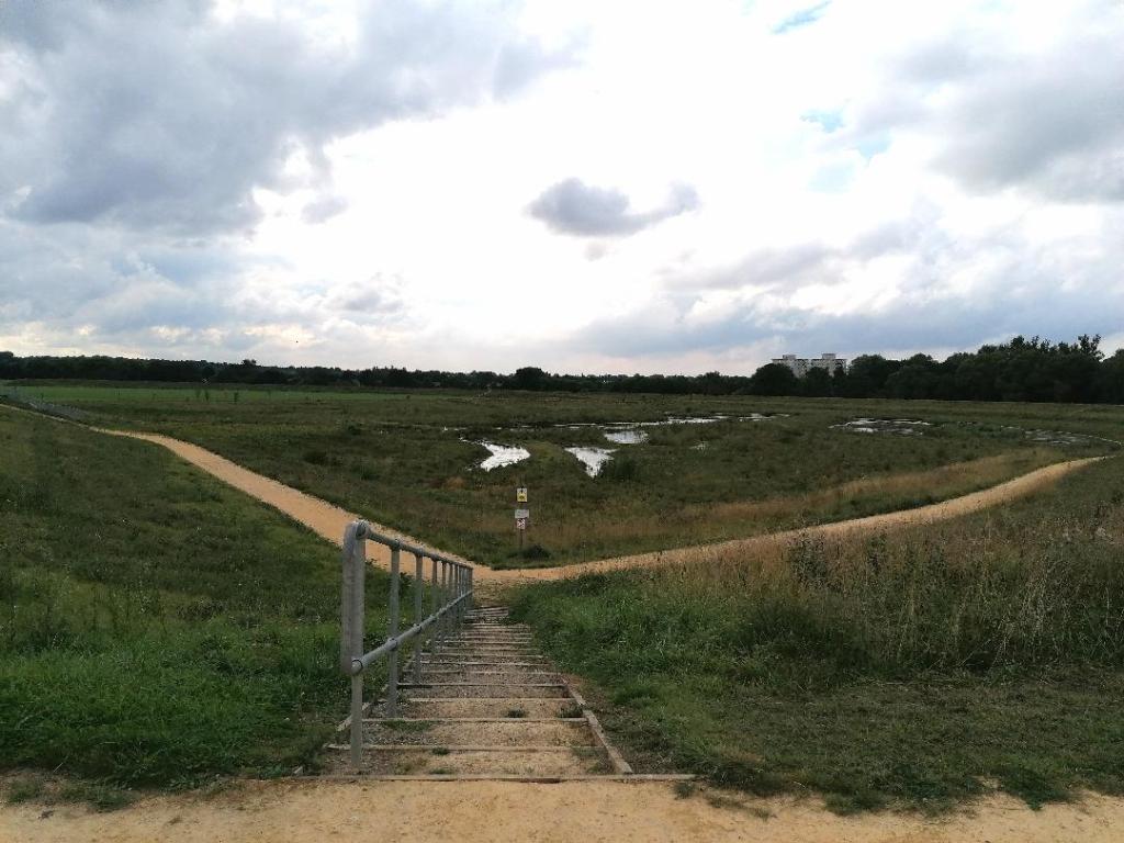
Once I arrived, I just had to cross the large roundabout to get to the park. I decided to have a good gander around the woodland paths first before I went up to the hall. I followed the riverside trail that led through the woods and alongside a small lake. There was plenty of life, both wild and domesticated. Children were feeding ducks and geese on the edge of the lake, and it was a popular dog walking spot so there were lots of canines running around.

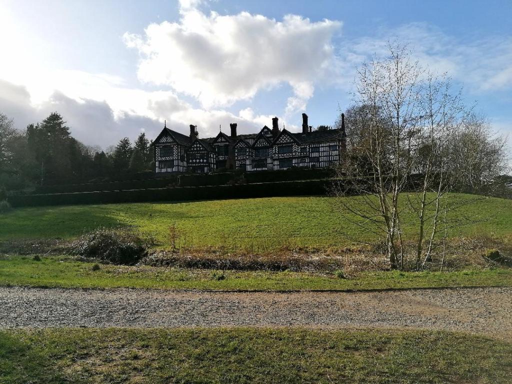
I made my way up to the hall to view the landscape below. After all that walking I was getting a bit peckish, so I headed to the café. I was given the option of sitting inside and having a traditional, restaurant-style meal, or sitting outside and ordering a quick lunch as a take away. I choose outside, I had to wait a bit, but finally I was able to tuck in to my soup and bread, brownie, and boozy hot chocolate.

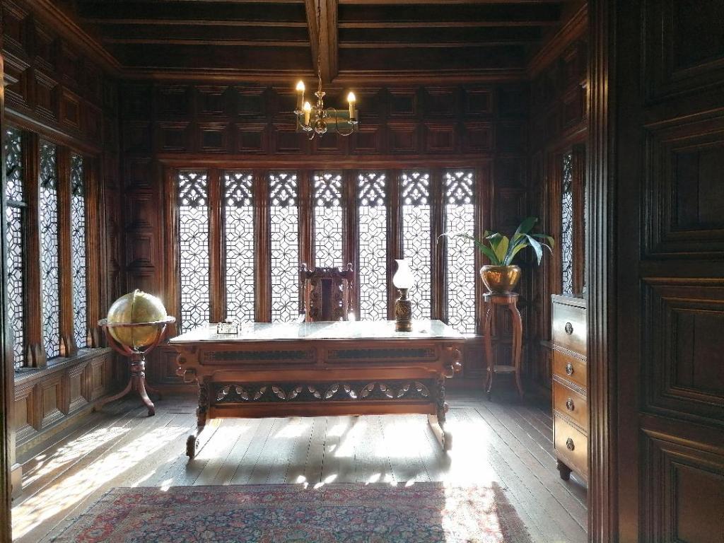
After eating, I headed to the visitor centre. There, I bought a £5 ticket for a self-guided tour of Bramall Hall. At the entrance, I was given a floor plan to follow and began on the one way system tour. It was incredibly captivating, most of the hall was set up to imitate how the Victorian occupants had lived their everyday lives. Because the site dates back to the early medieval period, some of the rooms were in the original or Tudor style. Each room had an information plaque explaining their main uses, including notable people and relevant events. I watched two videos which went into detail on some of the more intriguing architectural articles of the hall. Unusually, they also placed pine cones on many of the chairs and beds. These were a novel replacement for ‘do not sit’ signs, as a lot of the furniture was old and fragile. I’m not sure how well it worked though!

I was lucky enough to have my Bramall Hall tour all to myself, and when I was done I decided to go home. I did manage to record this route on OS maps, and called it ‘Bramall Hall’. I marked it as moderate, and even though I stopped for a break, I feel like I walked for more than 45 minutes. I did walk 2.49km (1.5 miles).

Bramall Hall has a very interesting history. Over a thousand years ago it was two separate estates, owned by Anglo Saxons. After William the Conquerors’ invasion, it changed hands to Hamon de Massey (or ‘Masci). Two hundred years later, Matthew de Bromale took up the estate. One of his descendants married a Davenport, and the hall remained in the family for a whopping 500 years. The estate was finally sold in the 1800s to the Nevills, and by 1935 the Hazel Grove and Bramhall Urban district Council had taken possession of the mansion.

From the outside, Bramall Hall appears very Tudor in style, however, the Nevills made lots of renovations in their time to bring it up to Victorian standards. The park was their doing, and it’s still in the Victorian romantic style today. Many rooms inside were refurbished according to Victorian fashions of the time.

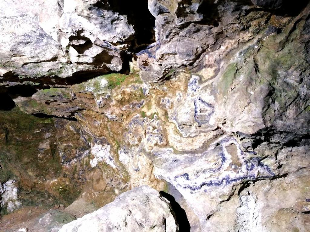
One room which managed to avoid a complete makeover was the solar room. This was a medieval family room for earlier inhabitants of the hall, and boarded up plastered walls had preserved their interior decorating. When the plaster walls were removed in modern times, fascinating Tudor murals were revealed underneath. These murals told many stories and painted many pictures, from moral messages encouraging observers to be good Christians, and nursery rhymes.

Links to the website used are listed below.

View of Bramall Hall from the grounds
Private study inside the manor

https://www.stockport.gov.uk/about-bramall-hall

https://www.stockport.gov.uk/about-bramall-hall/bramall-the-park

https://www.stockport.gov.uk/about-bramall-hall/a-thousand-years-of-history

https://en.wikipedia.org/wiki/Bramall_Hall#History

https://en.wikipedia.org/wiki/Solar_(room)

Happy walking!

Blue John Cavern

Sunday 13th February 2022

Cross street, Castleton, Hope Valley, S33 8WH

My partner and I planned a trip out for an early Valentine’s day. He mentioned he’d been to ‘Blue John mines’ as a kid and though it would be cool to revisit. On the day, we got the train from Manchester Piccadilly to Edale. We had been to Edale before, which is definitely a story for another time! On the train journey I tried to find a taxi that could take us to the cavern, because it was only a ten minute drive and it was pissing it down. No taxis would take us, so we decided to brave the weather. We stopped off at the Penny Pot Café for a cup of tea and some Wi-Fi access. There was no signal around Edale train station, but we did manage to use our phone data later in the journey. Once we had downloaded a map, we set off.

It took us about an hour to walk to Blue John Cavern. The weather wasn’t pleasant, but we maintained high spirits. For most of the journey there was a steady incline, and we had to take a few quick rest stops. Towards the end, we walked through a car park for Peak District hikers and ramblers. From that point, it was a sharp decline to our destination.

Blue John Cavern appeared to be a small house nestled in the mouth of a cave within a hill. The house turned out to be a gift shop, with an admissions desk, a small snack bar, and toilet facilities. We bought tickets, which were £15 for adults, and waited fifteen minutes for the next tour. Ten of us went down together, led by a very nice tour guide whose name I can’t remember, but he said he’d been working there since he was fourteen. And let me tell you, he definitely wasn’t fourteen anymore!

Before we descended into the cave, we were warned to watch our footing and use the handrail. There were hundreds of steps taking us down into the depths, and I clung on with an iron grip. We stopped several times on the way down, where the tour guide pointed out interesting features to us. It was fascinating, I took quite a few photos that didn’t turn out to be very impressive, but I managed to capture some sites that you don’t see every day.

Once reaching the end of the tour, we slowly made our way back up. Even though we could feel the climb in our calves, our guide gave us regular breaks so it wasn’t too strenuous. When we finally came back up for air, I bought a few crystals from the gift shop, and we had a speedy sandwich each before heading back. The return walk to the train station was somehow more pleasant, maybe due to the downhill stroll and the rain clearing up. We jumped straight on the train, but had to wait half an hour for it to set off. Feeling very damp and tired, we got an Uber from Piccadilly and were glad to peel our wet clothes off once we got in. While it wasn’t exactly the day we planned for, we enjoyed it nonetheless!

I had no signal to record a route on OS maps, but I estimate that our round trip ran roughly up to 12.8 km (8 miles), including the underground tour.

The caves have an interesting and diverse history, they are named after Blue John stone, which is a type of fluorspar only found in this area of the Peak District. The Romans were aware of the precious stone, but not this particular cavern, and ancient vases crafted from this material have been discovered. The name ‘Blue John’ is believed to derive from the French name ‘bleu jeune’, which means blue yellow. In the 18th century, French miners came to the cave to see what all the fuss was about. They noticed the blue and yellow colours in the dark stone, but after many years the French words were morphed in to the English ‘Blue John’. To add to the unusual past of this location, a man called Lord Mulgrave decided to host a dinner for the miners inside the cave. That particular spot on the tour is now marked as Lord Mulgrave’s dining room.

Links to any websites I’ve used are listed below.

Mam Tor Bridleway
A vein of Blue John stone inside the cave

https://en.wikipedia.org/wiki/Blue_John_Cavern

https://www.bluejohn-cavern.co.uk/history

https://www.britainexpress.com/attractions.htm?attraction=2284

Happy walking!

The Singing Ringing Tree

Wednesday 2nd February 2022

Crown Point road, Burnley, BB11 3RL

I was planning to see my family, so I decided to do something for my blog in the local area. There is a lot of potential in Rossendale for hikes and walks, and a lot of history there to. I’ve been to the Singing Ringing Tree a handful of times before when I was younger, so I felt that after all this while, I should visit it again.

I packed a bag and got the X43 from Chorlton street in Manchester, and got off at the Waggoners Inn in Clow Bridge. I was immediately hit by the wind and was glad I brought several layers. Once I felt that nothing was going to blow away, I headed up the footpath into the hills.

It was a sharp incline to get away from the road, then I just followed the footpath on top of the moor. I tried to take as many photos as I could because the views were impressive, however, I was a bit worried about the wind whipping my phone out of my hands. I got to a point where I could see the tree in the distance, on the peak of another hill. It was very striking, and I could clearly see my route ahead. I had to drop down towards the road first, then climb back up. I tried to stick to the more scenic course of the footpaths as much as possible, because I wanted to stay away from any cars.

As I got closer to the tree, near the top of Crown Point, I found a memorial forest called ‘Life for a life’. It was a cool and interesting idea that I wasn’t aware of before, and it was fascinating to see all those trees in different stages of growth. From this point, it took about two minutes to finally reach the tree.

Once I arrived, it was incredibly windy. I also completely forgot how the tree got its name, and I was surprised to hear the song of wind whistling through the pipes! I’m pretty sure I could see the whole of Burnley from the top of Crown Point. It wasn’t long before I started to get a bit chilly, so I started to turn back. If I stayed any longer I might have been blown over by the gusts!

On the way up I had noticed some other footpaths, and figured that I could take a short cut down to the road. I took a more direct path back to the road, and entered a field where I had to jump across several streams. So I’m not sure if it was really a shortcut or not. I got to witness an attractive sunset as I walked back along Burnley road. I hopped on the bus at Loveclough for a few stops before arriving at my parents’ house, feeling very windswept.

I marked my walk on the OS maps app and called it ‘The singing ringing tree’, and I covered 5.89km (3.7 miles). I considered this walk difficult, because there were a few steep inclines to get the blood pumping, and the incessant wind didn’t make it easy.

The singing ringing tree is a panopticon constructed in 2006. It was part of a project by the East Lancashire Environmental Arts Network, and it was one of four sculptures. The architects were Mike Tonkin and Anna Liu, and their design won the national award of the Royal Institute of British architects in 2007.

The life for a life memorial forests is a non-profit charity which focuses on providing comfort to grieving communities, conserving the environment and giving aid to other charities. The Crown Point memorial forest has been there since 2003, and is an ideal location as it’s a popular spot for ramblers. Not far from this site, Dunnockshaw woodlands has been developed. Crown Point is becoming a natural haven for wildlife, designed by humans.

Website links to interesting points in the area are below.

The Singing Ringing Tree
Crown Point Memorial Forest

https://www.lifeforalife.org.uk/forest-locations/crown-point/

https://www.woodlandtrust.org.uk/visiting-woods/woods/dunnockshaw-community-woodland/

https://en.wikipedia.org/wiki/Singing_Ringing_Tree_(sculpture)

Happy walking!

Castlerigg Stone Circle

Monday 17th January 2022

Castle lane, Keswick, CA12 4RN

For my birthday I decided to go to a stone circle, and took my partner with me. I did a bit of research, factoring in travel, weather and impressiveness and came up with a few options. I narrowed it down to Castlerigg in the Lake District because it had the best of all three.

On Monday morning we went to Piccadilly train station and had no problems with transport which was a relief because I do have a form. We had a changeover at Wigan North Western and got off at Penrith. As soon as we left the station I realised I’d been to here before! I recognised Penrith Castle from one of my previous trips to the Lakes. I later worked out that I’d gone through Penrith to get to Ullswater, but whenever anyone asks I can’t remember the names and just say I went to a waterfall.

The buses to Keswick weren’t very regular, so we decided to take a gander around Penrith Castle. Then we went to the park next door and I nearly fell over from dizziness after being spun round on a roundabout. It’s the little things that keep a relationship interesting! When it was time, we caught the X4 gold outside the station, heading in the direction of Keswick. Once in town, we were on the hunt for some brunch. We found a nice place that I unfortunately can’t remember the name of, but it was very tasty.

Once we were fed, it was time to head to the stone circle. We took a detour to skip pebbles on the river Greta, and after some debating over Google maps we were headed in the right direction. We were very lucky to have such good weather in January, and got to witness the circle at sunset. It was absolutely beautiful, and even more remarkable than what a Google image search yielded. There were a few other visitors, but it wasn’t too busy. After a few laps round the landmark, we walked down Castle lane for a bit, then turned back to town when it started to get dark.

While taking many photos, I managed to capture the first full moon of the New Year. It wasn’t hard because it was so big, and very inspiring. Once we got back to town, it was pitch black and definitely time to go home. The bus and trains took their time, but eventually we were nice and warm inside after an enjoyable and wholesome day out.

I was having too much birthday fun to record my route, but I estimate that we walked about 4 miles in total that day, when I round up a bit.

Castlerigg is believed to be one of the earliest stone circles of Britain, dated from 4000-5000 years ago. This puts it somewhere around the late Neolithic period, and the early Bronze Age. The circle stands on a natural plateau, which I originally assumed was just a thoroughly ploughed field. But it’s interesting to consider that this location was maybe chosen specifically for its geographical and environmental qualities, especially when you take into account the amazing views.

Inside this stone circle lies a small stone rectangle. This is quite unusual as the only other circle known to share this feature is the Cockpit, near Ullswater. It has been speculated that this rectangle marks a grave, however, unlike other ancient sites of this kind, there is no evidence of formal burials here. What has been discovered are some Neolithic stone axes, which suggests our ancestors traded certain goods in this spot. Some stones align with solar and lunar positions, posing the idea that the circle had astronomical significance. Other theories include social and religious rituals as the original purpose for the site.

While we’ll never truly know the real use for the stone circle, and the reason it was built, it could have been for all the possibilities listed above.

All links about the history of Castlerigg are listed below.

Castlerigg stone circle
First full moon of 2022

https://en.wikipedia.org/wiki/Castlerigg_stone_circle

https://www.keswick.org/explore/not-to-miss/castlerigg-stone-circle

https://www.english-heritage.org.uk/visit/places/castlerigg-stone-circle/history/

Happy walking!

Bridgewater Canal and Mamucium

Wednesday 12th January 2022

106 Duke Street, Manchester, M3 4RU

After having covid over Christmas and just being generally busy, I decided to go out for a walk. I was aiming to do something easy, just a stroll along the Bridgewater canal and researching its history. However, I discovered so much more than expected.

I got the 192 bus into town and walked through the city for about 20 minutes until I got to the canal. I passed Lock 91, which was where I had my work Christmas party. Later I found Lock 92, and it hurt my brain a bit trying to figure out how many locks there are and where they might be! I passed under and over some impressive bridges, and spotted some very pretty canal boats.

While I was walking along the water I saw a sign pointing to several different locations, but the one that caught my attention was the Roman fort. Now, I don’t mind admitting that I felt pretty silly not knowing that there was a Roman fort in Manchester until that moment. I immediately headed in that direction to see what I could find, and I was pretty impressed! I believe most of the fort is a reconstruction, but it was very interesting to walk around and I found some great views from the top. I spent some time in the garden below where there were some restored Roman foundations and information about Mamucium, as it was originally called.

Once I had had a good nosey around the fort, I made my way back to the canal. I did get a bit lost in deciding which side of the water I wanted to walk on, some of the bridge connections were quite confusing. Finally, I found a path to follow heading in the direction of Old Trafford. Despite being cold, it was a nice day which ended in an amazing sunset, so naturally I took many photos. At around 16:30 it started to get a bit dark and I started to get a bit chilly so I turned back. It was very invigorating to go out for what I thought would be a simple walk, and ended up uncovering an ancient history!

I forgot to start recording at the beginning of my walk, so the route on OS maps starts near Mamucium and is called ‘Bridgewater canal and Roman fort’. It was moderate in difficulty, and the distance recorded is 1.28km, but I estimate I did quite a lot more than that. I walked for about 2 hours, also the route on the app doesn’t show any part walking down the canal, so unfortunately I think that was missed off.

Mamucium Roman fort first began being constructed in 79AD. It had two other major reconstruction points in 160AD and 200AD. Before the second round of construction, the original Mamucium was actually demolished before it was built back up.

There is more than one idea of what Mamucium means. The first is that it references a ‘breast like hill’, where ‘mamm’ means ‘breast’. The second is that it’s referring to a local river goddess, where ‘mama’ means ‘mother’. Regardless of which theory is correct, it looks like Mamucium had some feminine inspiration.

Mamucium was a base for a Roman auxiliary cohort. Soldiers who were part of an auxiliary were not usually Roman citizens, but they could gain citizenship after doing their time for 25 years. Roman citizens could join legionary cohorts, and were paid better than auxiliaries. One reason why the Romans created a system to employ non-citizens, was so they could make use of the local skills of the people they conquered. However, they wouldn’t deploy them locally, presumably to avoid a clash of loyalties.

Surrounding Mamucium was a civilian settlement known as a vicus. These were made up of the families of auxiliary soldiers, and merchants. Apparently Mamucium was quite cosmopolitan in the Roman world and attracted people from all over. It really sounded like during the few hundred years that it was occupied, this settlement had a thriving economy.

Links to the history of the site are at the bottom of the post.

Bridgewater Canal


View of Mamucium Roman fort

https://www.bbc.co.uk/manchester/content/articles/2008/04/10/100408_roman_manchester_feature.shtml

https://en.wikipedia.org/wiki/Mamucium#Roman

http://www.caerphilly.gov.uk/romanfort/pdf/en/Teachers%20-%20Auxiliary%20Soldiers.pdf

https://en.wikipedia.org/wiki/Auxilia#Unit_types_and_structure

https://en.wikipedia.org/wiki/Vicus

Happy walking!

Hebden Bridge

Sunday 28th November 2021

Hebden Bridge, West Yorkshire, HX7 6JE

The end of November was the one year anniversary for me and my partner, so we decided to take a day trip to Hebden Bridge. He found a leaflet, liked the look of it and suggested we go there. I grew up in the area and have been to the town before, so naturally I agreed. We packed a bag each, put on our warmest clothes and caught the Leeds train from Manchester Victoria. It was only a half hour journey but transport was delayed because of snow.

Once we arrived we were greeted with a winter wonderland! It was still snowing and everything was absolutely covered in the stuff. Neither of us had a specific plan for the day and were happy to just wander and explore. Unfortunately, the visitor centre was closed so we headed to Calder Holmes Park. We crossed many bridges and walked along the Rochdale Canal. We found some ruins of an old abandoned building that we explored. It was really cool but due to the fact that we weren’t familiar with the area and that everything was obscured by snow, it’s impossible to pinpoint the location.

We headed into the town centre and perused the local market stalls, picking up some tasty Vietnamese street food. Then, deciding we needed something sweet, we went to the Bay Tree Café for cake and hot drinks. Once we were done, it was starting to get dark and we still had an hour and a half until the next train home, so we went wandering again.

We found a place that I would describe as a children’s play area. There was a treehouse and paths and stairs that led to lots of smaller areas to explore. It was a lovely space to stumble upon but because of the dark and the snow, we really didn’t know where we were! After strolling through the suburban areas and along the canal once more, we headed back to the station. We were on our way back to the city not long after, which concluded a very enjoyable first anniversary.

I recorded the route we took on the OS maps app titled ‘Hebden Bridge’. It’s 1.21km (0.75 miles) and marked as moderate. While we didn’t seek out a difficult trek to tread, it definitely felt longer than a mile! But maybe all of the snow made it more of a challenge.

Something new that I discovered about Hebden Bridge was the equine history in the town. In the past, work horses played an essential role in transport around Rochdale canal and the Pennines.

One of the central bridges in Hebden is known as the packhorse bridge, and was built in 1510. The settlement was known for textile production, and also for hospitable landladies. It was a fairly central location for the local packhorse routes that spread to Heptonstall, Burnley, Halifax and other towns. The job of packhorses was to carry goods over difficult terrain, and this line of work was maintained from the middle ages to the 18th century.

While the construction of canals made packhorses and their ancient routes obsolete, there was still work to be done. Boat horses would spend long days transporting cargo by pulling boats along the canal.

I’d like to share this poem I came across about the ancient packhorse routes of the area. I couldn’t find the poet, but it sounds like it could have been passed down by word of mouth anyway.

Burnley for ready money,
Mereclough nooa trust,
Yo tekken a peep at Stirperden,
But Ca’at Kebs yo must.
BlackshawYed for travellers,
An Heptonstall for trust,
Hepton Brig for landladies,
And Midgely on the Moor.
Luddenden’s a warm shop,
Roylehead’s varry cold,
And if yo go to Halifax
Yo mun bi varry bold.

Links to Hebden Bridges’ horse history are included at the bottom.

This sign is where I got the inspiration to research Hebden horse history
Rochdale Canal
Rochdale Canal all lit up

Happy walking!

https://en.wikipedia.org/wiki/Packhorse

https://www.hebdenbridge.co.uk/tourist-info/

https://www.hebdenbridge.co.uk/news/2016/021.html

https://www.nationaltransporttrust.org.uk/heritage-sites/heritage-detail/hebden-bridge-packhorse-bridge

Troy Quarry

Wednesday 6th October 2021

Helmshore, Haslingden, BB4 4AU

Today I met up with my auntie to go for a walk. I left Manchester, and headed up to Lancashire, meeting her in Rawtenstall (where I used to go to school) and she drove us to Helmshore. It’s one of those towns that I knew was nearby growing up, but I’m not very familiar with. We were blessed with good weather for most of the day, which was especially lucky considering the autumn rains have set in. We went on a short, circular walk around Troy quarry with some inclines and declines, which ended up totalling to 4.62km, nearly 3 miles.

It didn’t take us too long to get to the quarry from the car park, but when we did we were met with breath taking views, and a fence. In the middle was a body of water that I believe is a reservoir and behind was a beautiful hilly backdrop. Despite its practical use, the quarry did remind me of a lake settled within alpine mountains.

We rounded the pit and arrived at a large pond, where we took a break and watched a climbing group scramble up and down a cliff face. Then we continued and eventually walked through a charming field that was home to a stream and horses. I presume it belonged to a farmer because it looked very well maintained. Then we headed up the hillside to find the views of Ogden reservoir were worth taking a seat for. On the way back down, we found an animal pen with chickens, goats and what I think was an emu! The nearest farm was J&R Holt, so I imagine it belonged to them.

I recorded our route on OS maps as Troy quarry. It said it took us 1hr 17 mins, we did sit and talk on a few occasions so I’m not sure if that counts for time or not because it felt like we were out there for a while!

Troy quarry was opened in 1844, and during its period the stone was used to build Ogden reservoir. Apparently it fell out of use in the 1950s, but we did see some activity on the day. Maybe United Utilities knows something about that seeing as they own the land now!

I didn’t find out much more about the history of the quarry, but there used to be a settlement in the area called Grane Village, which is now abandoned. Amongst other work such as milling and farming, it’s likely that some residents were employed at the Troy site. The population began to decline with the construction of the Ogden reservoir. Land was bought up for the project so the people dispersed to other areas of Haslingden. This appears to have happened between 1900-1912.

Fifty years earlier, Grane ran its own illegal whisky distilling industry. Even though the village doesn’t exist anymore, it certainly had some very colourful stories!

Links to the history of the area are included at the bottom.

View of Troy Quarry
Popular climbing spot

Happy walking!

http://www.valleyofstone.org.uk/journey/heritagesites/troyquarry

https://www.ukhillwalking.com/forums/rock_talk/troy_quarry_what_should_i_have_done-718962

https://en.wikipedia.org/wiki/Haslingden_Grane

St Saviours Church

Monday 20th September

Plymouth House, 1 Plymouth Grove, Manchester M13 9PZ

I had had a very lazy day off and decided to go for a walk in the evening to shake off the cobwebs, but kept it very local. I had always wondered about a graveyard that looked like there used to be a church there, but was just a graveyard now. I decided to check it out, it was only about 10 minutes from my house.

Apparently it called Southern Manchester cemetery, not to be confused with Manchester Southern cemetery in Chorlton. It was nice to find a small plot of land that felt historic and mysterious in the middle of a built up area. The gravestones that I could see were from the 19th century and there was a grassy mound in the centre of the area with steps, which is why I thought a church used to be there.

When I decided to go back, I passed through a small but very pretty field where the path was line with beautiful flowers. It’s the kind of path that I’ve tried to explore before, because it looks like it goes somewhere interesting. It doesn’t, really! But it can be accessed from Kincardine road.

I was amused to observe some rowdy campers with a tent and a fire in the field on a Monday evening! I have no idea why they were there or how legal it was but they sounded like they were having fun.

The walk only took me about 30 minutes maximum, and was 1.12 km (0.7 miles). I recorded the route on OS maps, titled unnamed graveyard.  

I also did a bit of digging because it felt like there was a mystery here that needed to be unearthed.

It took a while for me to discover but there did used to be a church here called St Saviours Church! It was an Anglican parish church that was consecrated in 1836 and could seat up to 1700 members. During the time of St Saviours there were some changes in the parish. In 1868, part of the parish was assigned to St John Chrysostom, there is a school in the area called St Chrysostom’s so I assume it was named after the same man! The church was demolished in 1964 and in 1971, the remaining members followed St Luke. A new church did replace the old one in the same spot, but this was soon demolished in 1974.

I was surprised that I could find any information on the history of the local area, but I have included the links of websites that provided it at the bottom.

St Saviours Church, Pauline Leech (1964)
Southern Manchester Cemetery
Near Kincardine Road

Happy walking!

https://manchesterhistory.net/manchester/gone/stsaviours.html

https://en.wikipedia.org/wiki/St_Saviour%27s_Church,_Chorlton_on_Medlock

Peel Park and Kersal Wetlands

Friday 10th September 2021

The Crescent, Salford M5 4WU

Littleton Road, Salford M7 2FX

I thought I’d try this ‘building my brand’ through blogging thing because I want to create a passive income. I know I have to be patient and keep at it, but I might as well give it a go. If you stop seeing blog posts from me all of a sudden, it’s because I’ve never been good at keeping a diary!

My name is Tallulah and I’m based in the Manchester area in the UK, so that’s where I hope a lot of my posts will be based. I plan to post at least once a month, but we’ll see how it goes.

I got an unexpected day off from work today, so I decided to go for a walk. I’ve been thinking recently how I want to go further a field in Britain to natural attractions and ancient sites, but I opted to stay local for now. I often go past Peel Park in Salford on the number 50 bus, and I’ve always been curious as to what it’s like. So I took that same bus and was pleasantly surprised! It has a flower garden, plenty of green space, and the river Irwell runs right by it. The park wasn’t too busy, since it wasn’t the weekend yet. The weather was good, a little overcast but I did get my sun cream out. Once I had walked through most of the park, I continued to follow the river Irwell.

I had been wondering about Kersal Wetlands… I had been to Kersal Moor in the past, and an acquaintance had recommended the wetlands to me as a place to visit. I was again pleasantly surprised when I realised it wasn’t too far from Peel Park! I checked on the OS maps app and headed over. I walked through a built up area for a bit, maybe about twenty minutes, but then I found the entrance to Kersal Wetlands.

 It was bigger and even quieter than Peel Park. It was nice to be alone and I even got the chance to pee behind a bush at one point! I circled the wetlands, then followed the river further into the park. There were lots of Himalayan balsam which I enjoyed. Eventually I came to a sign warning of hogweed plants in the area, (which are apparently dangerous), so I turned around and headed back. I retraced my steps on the same route I’d taken to get there.

Once I returned to Peel Park, I went to The Meadow, which I’d seen on OS maps. It was a nice walking area, but it took some time to cross the river and return to the bus stop. I also got distracted by a cat!

I mapped part of my route on OS Maps called ‘peele park’ (spelt wrong). It begins in Kersal Wetlands and ends at Adelphi foot bridge near The Meadow, and is marked as moderate. In total I walked roughly about 4 miles (6.4km).

Peel park
Kersal wetlands

Happy walking!